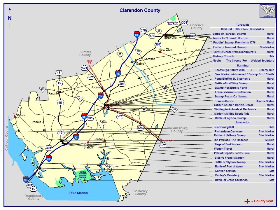
Swamp Fox Murals, SC, Locate Us:
Clarendon County, SC the north shore of Lake Marion, Historic U.S. 301 - “Highway to Southern Living” Named Swamp Fox Trail in 1925
Murals Maps by towns:
/\ Murals Map of Manning, SC
\/ Mural Map of Paxville, SC
Historical Sites and Markers Locations:
Battle of Tearcoat Swamp: 33° 48′ 52″ N 80° 08′ 34.4″ W
Ambush at Benbow’s Ferry site: 33° 41′ 27″ N 80° 12′
Ox Swamp at Pocotaligo: 33° 42′ 50.7” N, 80° 12′ 04” W
Battle of Wyboo Swamp: 33° 32′ 21.6” N, 80° 12′ 59.6” W
Battle of Halfway Swamp: 33° 39′ 04.8” N, 80° 29′ 46.5” W
Richardson Cemetery: 33° 38′ 14″ N 80° 29′ 28″ W
Siege of Fort Watson: 33° 32′ 20” N, 80° 26′ 15” W
Battle of Great Savannah: 33.49166 ° N, 80.355° W
Visiting the sites require walking.
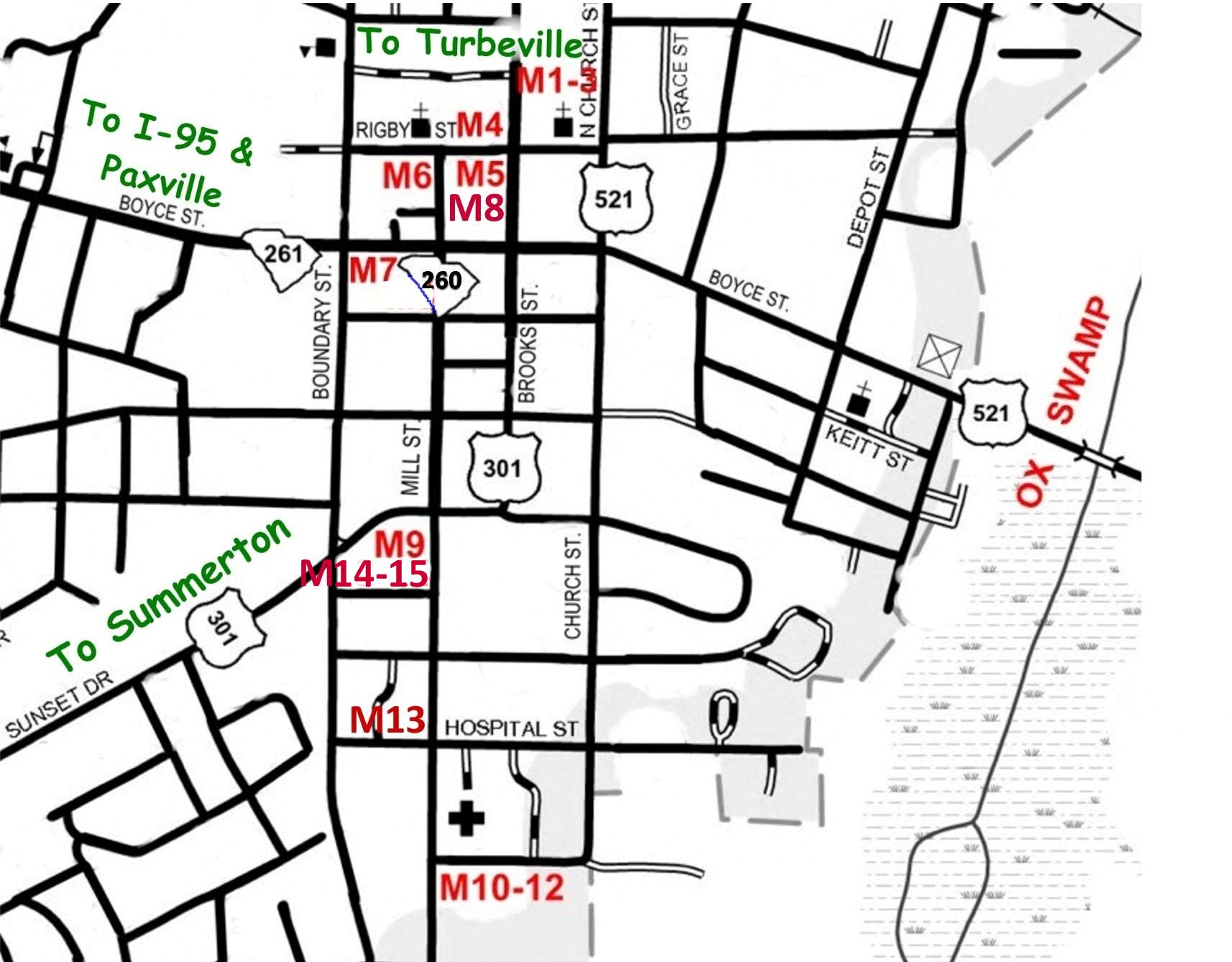
Mural and statue sites with GPS: Manning : list South to North:
M 10-12 Wyboo Swamp: IGA, 600 South Mill St.: 33°41’9.7″N 80°12’39″W
M 13 Marion Militia Needs: Anderson Pharmacy, 419 South Mill St.: 33°41’16.8″N 80°12’45″W
M 9 Citizen Soldier: Piggly Wiggly, Sunset Dr. and South Mill St.: 33°41’26.6″N 80°12’44.6″W
M 14-15 Waiting in Ambush at Benbow’s: Piggly Wiggly, Sunset Dr. and South Boundary St.: 33°41’26.0″N 80°12’47.44″W
M 7 Swamp Fox at Ox Swamp: Manning Fire Dept., 38 West Boyce St.: 33°41′ 42″N 80°12′ 47″W
M 6 Reflections: Citi Trends, Rigby and North Mill Sts.: 33° 41′ 47″ N 80° 12′ 42.6″ W
M 8 Francis Marion Statue: Clarendon Chamber, 19 North Brooks St.: 33° 41′ 42.4″ N 80° 12′ 43.5″ W
M 5 The Swamp Fox Burst Forth: Sub Station II, 37 North Brooks St.: 33° 41′ 46.5″ N 80° 12′ 39″ W
M 4 Halfway Swamp: Domino’s Pizza, 1 Rigby and North Brooks Sts.: 33° 41′ 49″ N 80° 12′ 38.7″ W
M 1-3 Pond Bluff to St. Stephen’s Church: Simpson’s ACE Hardware, 110 North Brooks St.: 33° 41′ 51.6″ N 80° 12′ 36″ W
M S Francis Marion Sculpture: FE DuBose Campus, Central Carolina Technical College, 3351 Sumter Hwy., US 521: 33°43’33” N, 80°11’56.4” W
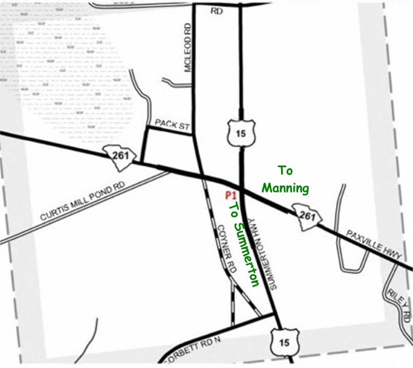
Paxville (at stoplight):
P 1 Richbourg Mill to Ox Swamp: Short Trip, US 15 & SC 261: 33° 44′ 18.4″ N 80° 21′ 27.4″ W
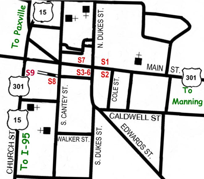
Summerton: Mural sites listed North to South
S 1 The Patriot: Gater’s, 203 Main St.: 33° 36′ 29.3″ N 80° 20′ 56.7″ W
S 2 The Redcoat: Summerton Hardware, 202 Main St.: 33° 36′ 28.7″ N 80° 20′ 56.8″ W
S 3-6 Siege of Fort Watson: Summerton Hardware, 140 Main St.: 33° 36′ 28.7″N 80° 20′ 58.6″W
S 7 Wagon Travel: Walker Bldg., 129 Main St.: 33° 36′ 29.7″ N 80° 20′ 59.9″ W
S 8 Patriot at Scott Lake: Ginger’s, 4 South Cantey St.: 33° 36′ 28″ N 80° 21′ 05″ W
S 9 Elusive Marion: Clarendon School District, 5 South Church St.: 33.6077° N 80.3527° W
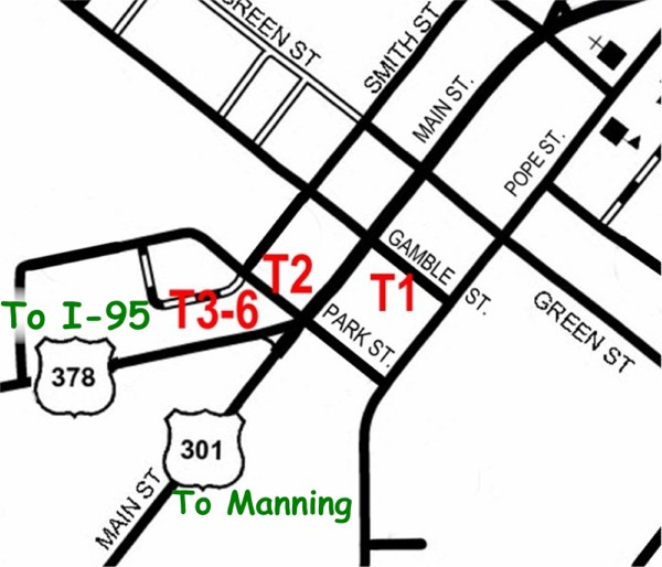
Turbeville: Mural sites listed East to West
T 1 Puddin Swamp: 1492 Main St.: 33° 53′ 26.8″ N 80° 01′ 08.1″ W
T 2 New Tearcoat Swamp: Dollar General, 1401 Main St.: 33° 53′ 25.7″N 80° 01′ 14.5″W
T 3-6 Burning of Mouzon’s: Corner of Main and Calvert Sts. – 2 sides: 33° 53′ 24.5″ N 80° 01′ 13.4″ W & 33° 53′ 24.3″ N 80° 01′ 13.8″ W
Visit Mural and Historical Sites across Clarendon County, SC!

*
Francis Marion Trail Commission Driving Map,
Clarendon County:
1. Ox Swamp,
2. Wyboo Swamp,
3. Halfway Swamp,
and Richardson Cemetery,
4. Fort Watson
(Swamp Fox Murals and Rev. sites for these and many more in Manning, by the lake, in Summerton and on the way North and in Turbeville.)
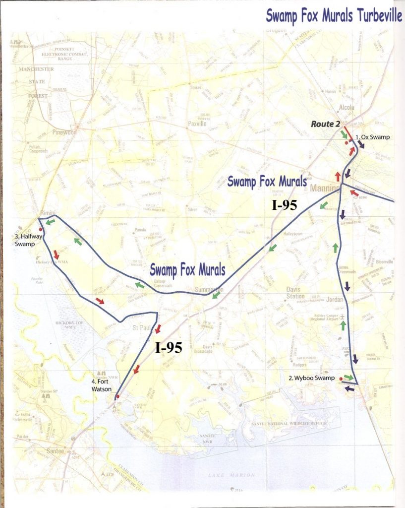
Follow the Swamp Fox Murals Trail on Historic US 301 Through Turbeville, Manning & Summerton, SC
Visit a Mural or Historical Site!
History Tour Apps
Follow and tour with the Liberty Trail, SC App.
Explore: Swamp Fox Murals Trail - New Mobile Friendly
Explore: Swamp Fox Murals Trail - New Mobile Friendly - Clarendon County, great on your phone!
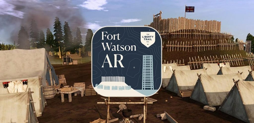
Download Fort Watson AR, App! Download at your App Store or Google Play
Download Fort Watson AR, App! Download at your App Store or Google Play
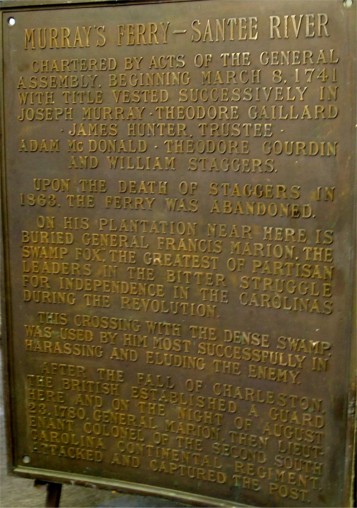
Up river on the Santee from Murray’s Ferry was Nelson’s Ferry and further west was Vance’s Ferry at the site of the current I-95 and older US 301 bridges. This article was published in the Manning Times July 22, 1925.
This bridge was to been named The Francis Marion Bridge.
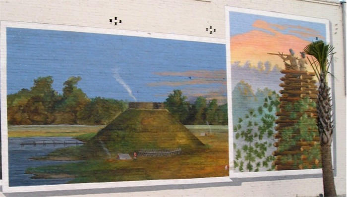
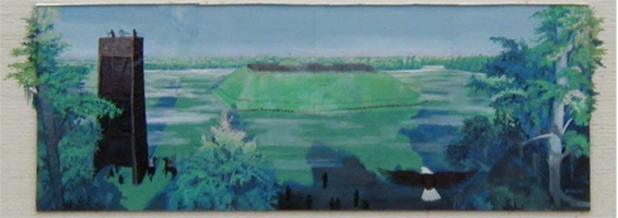
Santee Indian Mound/ Fort Watson
National Register of Historic Places – 1969 Historical evidence used for the “Archeology at Scott Lake, 1973” and Wanton, 1939, support the ancient Indian Province of Cofitachiqui being located at the upper part of the Santee River. Records and maps from 1540’s show that Cofitachiqui was at Scott Lake, (now Lake Marion, or near Pine Island Unit of Santee NW Refuge). Santee Indian Mound was constructed as a ceremonial and burial mound and there were more mounds in this area. These mounds served as sub-structure platforms for ceremonies about 800 years ago. The British built the fort on the mound because of its strategic location. The British used it during the Revolution to control movement on the Santee River as well as the main road between Charleston and Camden. In the third and final battle of Fort Watson, this was the first post in South Carolina taken from the British. On April 15, 1871, Gen. Francis Marion and Lt. Col. Henry “Lighthouse Harry” Lee encircled the fort and after 8 days of futile small arms fire, Maj. Hezekiah Maham contrived to construct a pine log tower of sufficient height to overlook the defender’s stockade. On April 23, 1781, the Americans mounted an attack from the tower and from the ground which lasted only a short time. Lt. McCoy surrendered the fort, its garrison and supplies to General Marion, the “Swamp Fox”.
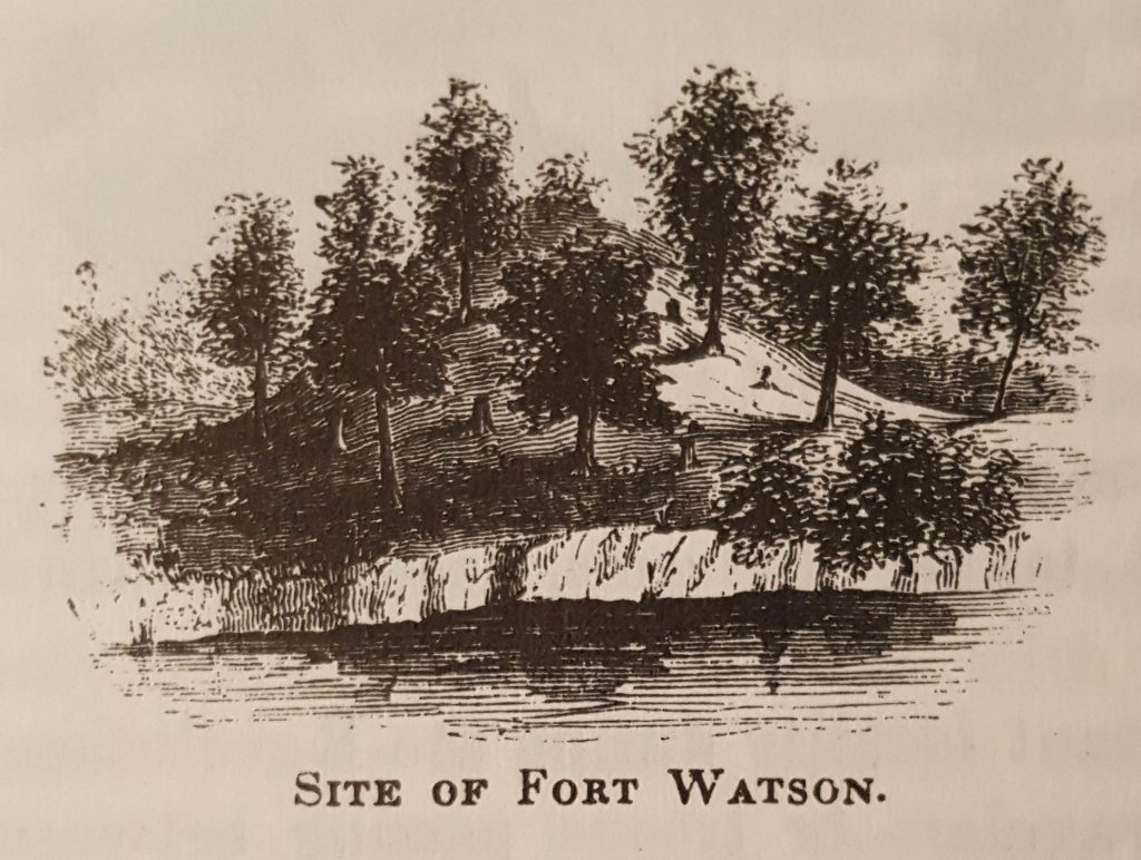
Santee Indian Mound is included as part of the Santee National Wildlife Refuge. A current Santee Indian Chief visited this site many times in 2000-2002. (Located west of I-95, Exit 102, US 301/15 to County Road 803, 9 miles SW of Summerton 33.539° N 80.438° W)
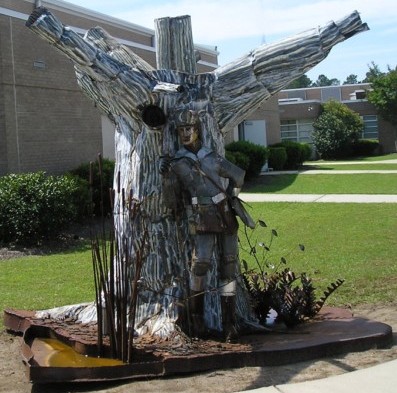
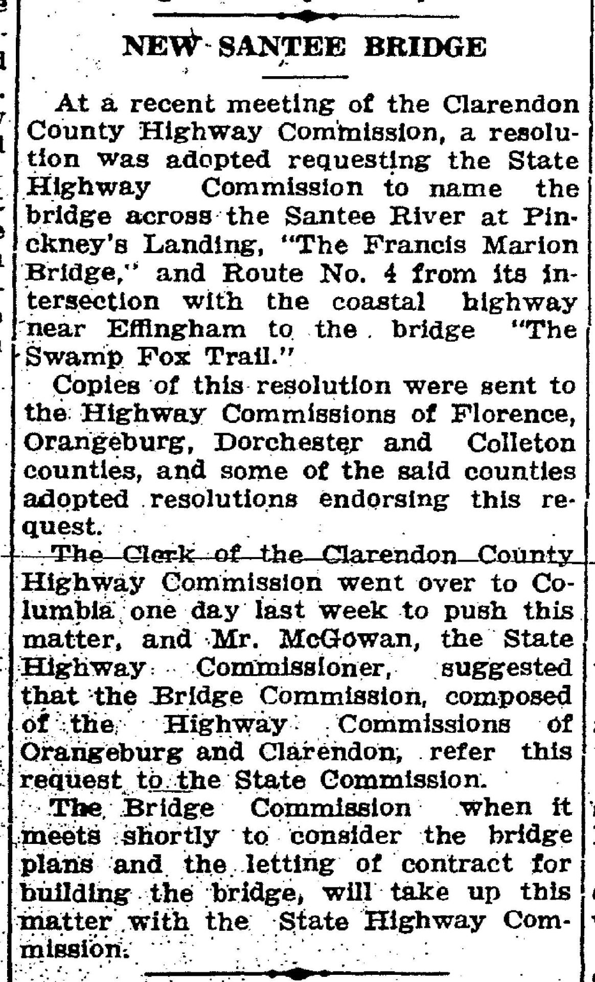
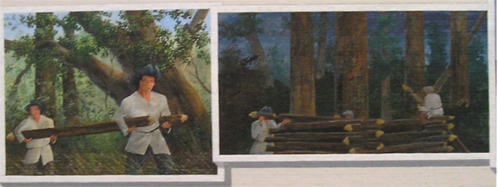
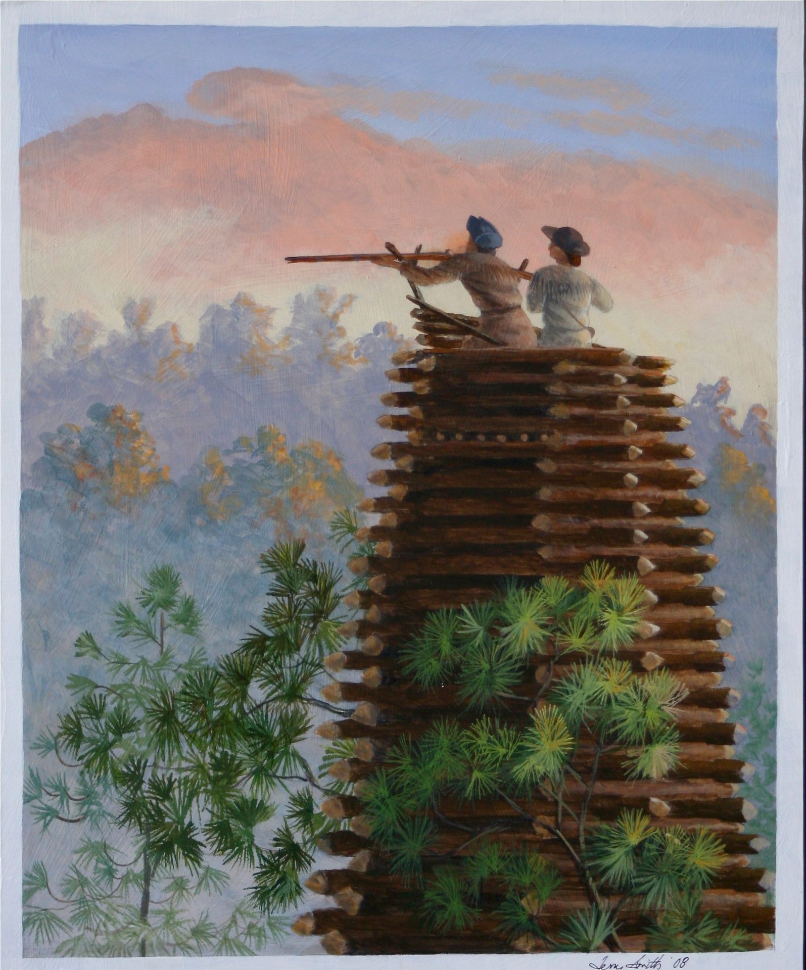
Terry Smith constructs a new interpretation of Fort Watson, March 2009.
Replacing 3rd mural, New total: 23 mural panels: Siege of Fort Watson Mural:
Colonel Lee and Lee’s Legion joined General Marion and Marion’s Brigade on the Santee River. They elected to capture British-held Fort Watson to get supplies. General Thomas Sumter had attacked Fort Watson unsuccessfully on February 28, 1781. Marion’s men laid siege to Fort Watson for many days starting April 16, 1781. While waiting for a cannon to arrive, Major Maham contrived to build a tower so high that it overtopped the fort, to have sharpshooters pick off the Redcoats inside the fort. The Patriots gathered saplings for several days and constructed the tower overnight. The use of the tower led to the capture of Fort Watson on April 23, 1781, and was the final Battle of Fort Watson.
These 11′ to 17′ x 77′ murals are donated by the Swamp Fox Murals Trail Society, 2009, to bring alive Revolutionary War history on Summerton’s Main Street on Summerton Hardware.
- Artist: Terry Smith, Land O’ Lakes, Florida
- Mural: 33° 36′ 28″ N 80° 20′ 59″ W & Indian Mound Site: 33.539° N 80.438° W
- Follow the Swamp Fox Murals Trail on Historic US 301: Summerton, Manning, Paxville, Turbeville, SC
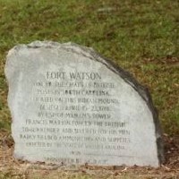
Historic Marker at Santee Indian Mound
- In 1950 the SC DAR erected this Historic Marker at Santee Indian Mound for Francis Marion taking Fort Watson, 1781.
- Historic Markers database includes Swamp Fox murals and this DAR marker.
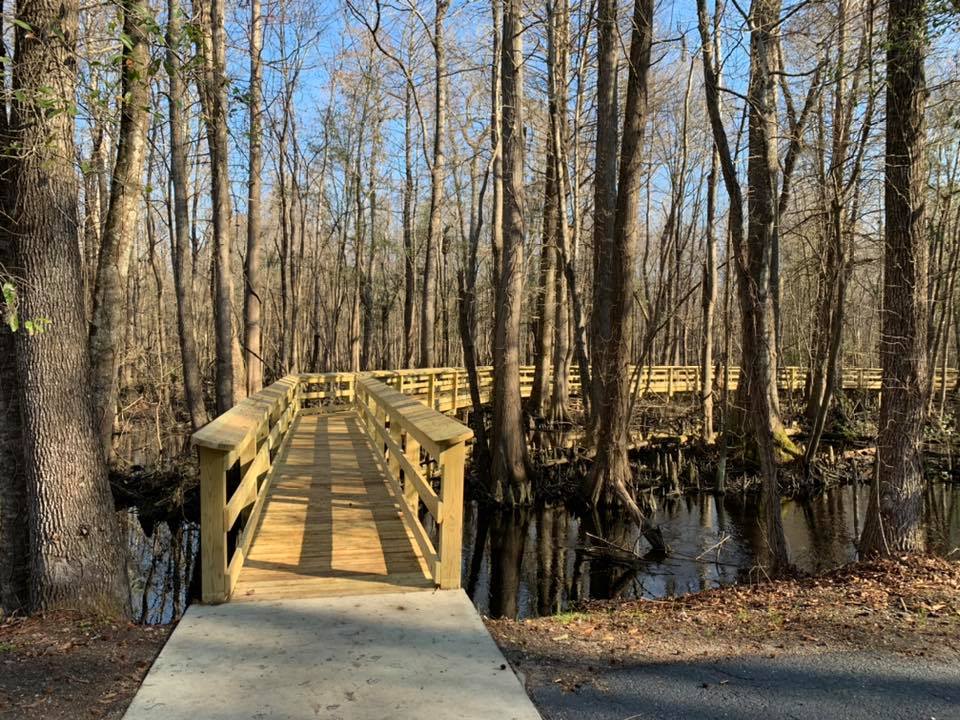
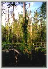
(Re-opened boardwalk) The Pocotaligo River has headwaters in Sumter County in streams such as Green Swamp, Piccolo Creek, Nasty Branch, Bunsen Swamp, Long Branch and Hatchet Camp Branch. It flows across Clarendon County to join Black River, flowing into Williamsburg County. Pocotaligo moves through miles of concealed silent swamps, wild and shrouded secrets since the days of the Indians, its wildlife sequestered. Glimpse into its murky magnificence from a boardwalk trail at a small park on the north edge of Manning. Access: From downtown Manning go North on US 301 for 1.6 miles to an entrance on West and South of the river’s bridge. From the parking and picnic area, follow the signs to the Boardwalk. This 1/2 mile boardwalk allows visitors to see native trees such as black gum, bald cypress, water tupelo, bay, willow oak and red maple. Wildlife includes wood ducks, songbirds, amphibians and an occasional glimpse of a reptile. On a treasure hunt, find the nature walk: 33° 42′ 51″ N 80° 12′ 04″ W Historic Ox Swamp Marker, Nature Walk, and Liberty Tree.
"Brief History of General Francis Marion" by Dr. Joe T. Stukes, including Marion becoming the Swamp Fox
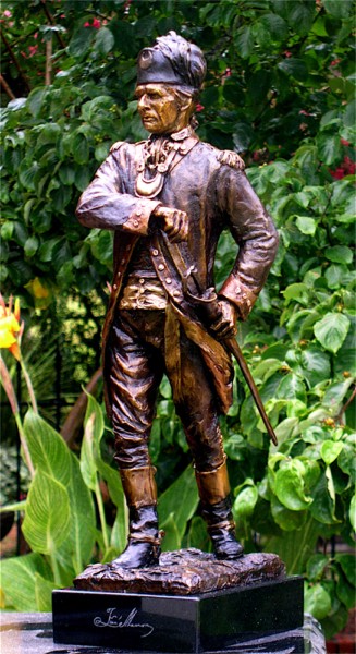
Bronze Statue of General Francis Marion
This bronze statue of General Francis Marion stands in the window of Clarendon County Chamber of Commerce office at 19 North Brooks Street, Manning, SC. From all reference sources, this Bob Barinowski statue is the best likeness ever done of General Marion. Barinowski sculpted this Marion in 2006.
February 27-28, 2015 was the best-ever: with about 800 participants even with cold and held inside.
American Revolutionary Francis Marion Days Living History Encampment and Celebration of “General Francis Marion Memorial Day and Victory at Wyboo Swamp”, Camp Bob Cooper, Summerton, SC.
Held to honor General Francis Marion Memorial Day, which the South Carolina Legislature designated as February 27 across the state. The Swamp Fox Murals Trail Society sponsored General Francis Marion Days Living History. We aged out, but honoring General Marion goes forth with the Francis Marion Symposium, Manning, SC every October.
Come find this Francis Marion statue in Manning: 33.696° N 80.211° W
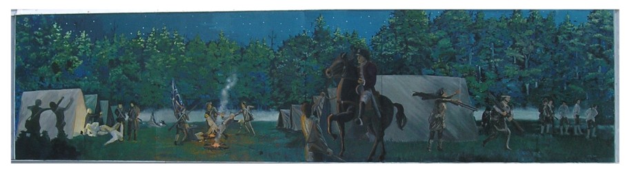
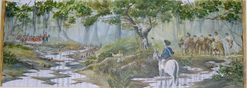
Battle of Tearcoat Swamp Original Mural
In the American Revolution, October 25, 1780, General Marion learned Colonel Tynes with a party of over 90 drew supplies and new muskets at Camden. Tynes was camped at the edge of Tearcoat Swamp between the forks of the Black River. Marion called a muster and with 150 men moved to Kingstree. He then turned west and moved swiftly toward Tearcoat. After scouting the encampment Marion split his force into three companies and attacked at midnight. The attackers killed six, wounded 14 and captured 23 men. They also captured the food, baggage, ammunition, eighty new muskets and horses with saddles. However, Tynes escaped, but was captured a few days later in the High Hills.
- The citizens of Clarendon County and the Town of Turbeville donated this mural in Turbeville, SC.
- Artist: Will Anderson, Stateburg, SC. (Original Edition) (Mural Painted on West wall of Dollar General, Park St., Turbeville, SC June, 2002, refurbished 2008.)
- Revolutionary History in Clarendon County, SC with General Francis Marion, The “Swamp Fox”.
- Follow the Swamp Fox Murals Trail on Historic 301: Manning, Paxville, Summerton, Turbeville, SC.
- Find this 8′ x 32′ mural 33° 53′ 26″N 80° 01′ 15″W and Tearcoat site: 33.814° N 80.143° W
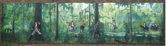
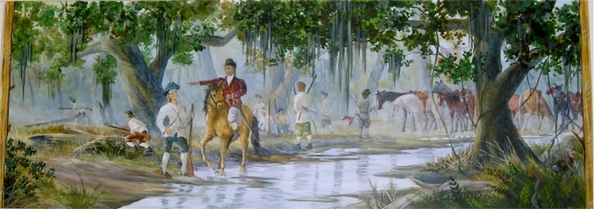
Swamp Fox at Ox Swamp Mural
This Swamp Fox Mural in Manning, completed December 2001, is the 1st mural
In the American Revolution, November 8, 1780, General Francis Marion and his militia lured British Colonel Tarleton and his Green Dragoons about 26 miles from Jacks Creek through the swamps (Sammy and Pocotaligo) to Ox Swamp. After spending 6 hours in this pursuit, Tarleton gave up the chase saying “as for the old fox (Marion), the devil himself could not catch him.” Thus, Gen. Marion became known as the “Swamp Fox.”
- The citizens of Clarendon County and Manning donated this mural in Manning.
- Artist: Will Anderson, Stateburg, SC, 2001.
- (The 12 foot x 48 foot mural is painted on West wall of the Manning Fire Station, corner of 42 W. Boyce and Boundary, completed December 2001, refurbished to restore: 2008 and 2016.)
- Follow the Swamp Fox Murals Trail: Manning, Paxville, Summerton, Turbeville, SC.
- Look for this 12′ x 48′ mural. 33` 41′ 42″N 80` 12′ 46″W & Ox Swamp site: 33.692 N 80.201 W
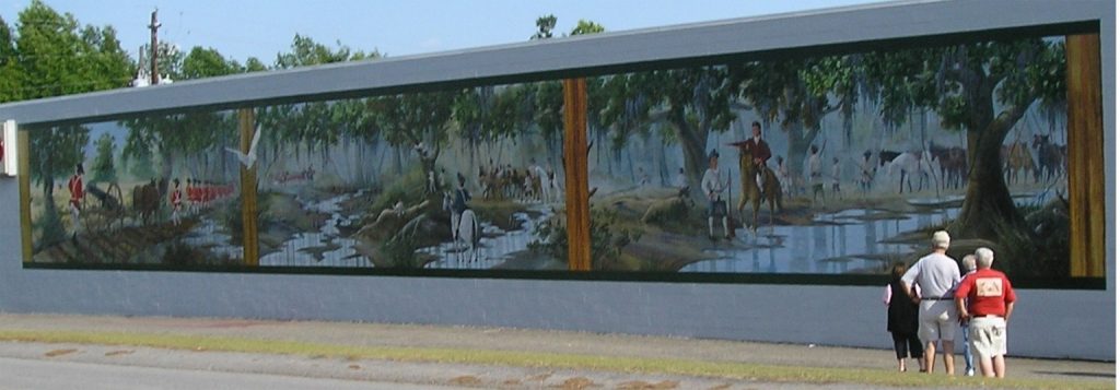
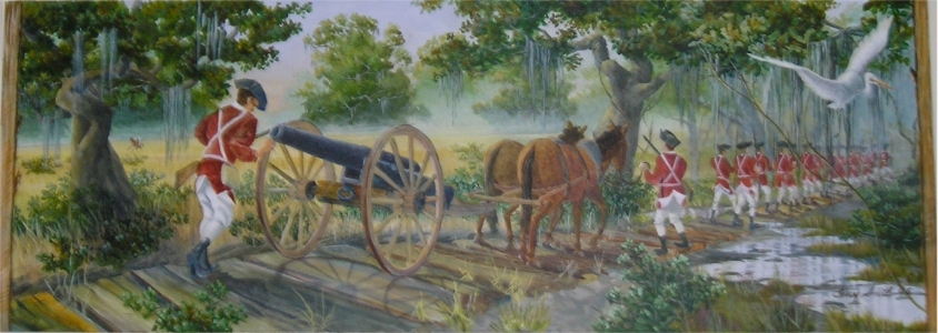
Battle of Wyboo Swamp
Largest mural in Manning, April 2006, these panels are the 12th – 14th murals.
As part of the Bridges Campaign: Battle of Wyboo Swamp (Tuesday, March 6, 1781)
During the American Revolution, the Bridges Campaign or Watson Chase started March 6, 1781. Colonel Watson and British troops from Fort Watson were sent to crush General Marion. Marion’s Militia challenged them on the quarter-mile causeway over Wyboo Swamp. The cavalry clashed several times on the causeway. When the cannon arrived Marion withdrew to a position near the John Cantey Plantation. One of Marion’s men, Gavin James, personally killed three Tory dragoons on the causeway. He shot one and then bayoneted two from his horse.
- The Swamp Fox Murals Trail Society commissioned this mural for the IGA, 600 S. Mill St and Bozard St. in Manning, 2006.
- Artist: Terry Smith, Land O’ Lakes, Florida Prints (11″ x 17″) of the 3 panels are available NOW.
- Look for these 12′ x 105′ murals: 33° 41′ 10″ N 80° 12′ 39″ W and Wyboo Swamp site: 33.539 N 80.218 W
Summary of Mural Locations with GPS
- Manning: Murals and statues sites listed South to North:
- M 14-15 Waiting in Ambush at Benbow’s Ferry: 36 Sunset Dr. and S. Boundary St.: 33° 41′ 27″ N 80° 12′ 45″ W
- M 13 Marion Militia Needs: Anderson Pharmacy, 419 S. Mill St.: 33°41’16.8″N 80°12’45″W
- M 10-12 Wyboo Swamp: IGA, 600 S. Mill St.: 33° 41′ 10″ N 80° 12′ 39″ W
- M 9 Citizen Soldier: Piggly Wiggly, S. Mill St. and Sunset Dr.: 33° 41′ 27″ N 80° 12′ 45″ W
- M 7 Swamp Fox to Ox Swamp: Manning Fire Dept., 38 W. Boyce St.: 33° 41′ 42″N 80° 12′ 46″W
- M 8 Marion Statue: Clarendon Chamber of Commerce, 19 N. Brooks St.: 33.696° N 80.211° W
- M 6 Reflections: Citi Trends, Rigby and Mill Sts.: 33° 41′ 47″ N 80° 12′ 42″ W
- M 5 The Swamp Fox Burst Forth: Sub Station II, 37 N. Brooks St.: 33° 41′ 47″ N 80° 12′ 39″ W
- M 4 Halfway Swamp: Domino’s, Rigby and N. Brooks St.: 33.69703°N 80.210767°W
- M 1-3 Pond Bluff to St Stephens Church: Simpson’s ACE Hardware, 110 N. Brooks St.: 33° 41′ 51″ N 80° 12′ 36″ W
- Francis Marion Sculpture: FE DuBose Campus, Central Carolina Technical College, 3351 Sumter Hwy, US 521: 33.725° N, 80.2° W
- Paxville: (at stoplight):
- P 1 Richbourg Mill to Ox Swamp: Short Trip, US 15 and SC 261: 33° 44′ 19″ N 80° 21′ 28″ W
- Summerton: Murals sites listed North to South:
- S 1 The Patriot: Gater’s, 203 Main St.: 33° 36′ 30″ N 80° 20′ 57″ W
- S 2 The Redcoat: Summerton Hardware, 202 Main St.: 33° 36′ 30″ N 80° 20′ 57″ W
- S 3-6 Fort Watson: Summerton Hardware, 140 Main St.: 33° 36′ 28″N 80° 20′ 59″W
- S 7 Wagon Travel: Walker Bldg., 129 Main St.: 33° 36′ 30″ N 80° 21′ 00″ W
- S 8 Patriot at Scott Lake: Ginger’s, 4 S. Cantey St.: 33° 36′ 28″ N 80° 21′ 06″ W
- S 9 Elusive Marion: Clarendon School District, 5 S. Church St.: 33.608° N 80.353°W
- Turbeville:
- T 1 Puddin Swamp: 1492 Main and Gamble Sts.: 33° 53′ 27″ N 80° 01′ 08″ W
- T 2 Tearcoat Swamp: Dollar General, 1401 Main St.: 33° 53′ 26″N 80° 01′ 15″W
- T 3-6 Burning Mouzon’s: Corner of Main and Calvert Sts. – 2 sides: 33° 53′ 25″ N 80° 01′ 14″ W
Siege of Fort Watson Original Mural
Colonel Lee and Lee’s Legion joined General Marion and Marion’s Brigade on the Santee River. They elected to capture British-held Fort Watson to get supplies. General Thomas Sumter had attacked Fort Watson unsuccessfully on February 28, 1781. Marion’s men laid siege to Fort Watson for many days starting on April 16, 1781. While waiting for a cannon to arrive, Major Maham suggested building a tower to have sharpshooters pick off the Redcoats inside the fort. The Patriots gathered saplings for several days and constructed the tower overnight. The use of the tower led to the capture of Fort Watson on April 23, 1781, and was the final Battle of Fort Watson. (12′ x 32′ mural)
- The citizens of Clarendon County and SC Public Service Authority (Santee Cooper) donated this mural in Summerton, SC.
- Artist: Will Anderson, Stateburg, SC. (Mural Painted on east wall of Summerton Hardware, Duke St., Summerton, SC December, 2002, destroyed 2008.)
- Follow the Swamp Fox Murals Trail on Historic 301: Manning, Paxville, Summerton, Turbeville, SC.
"The Swamp Fox Song"
My name is Francis Marion. I fought the British redcoats in ’76,
Hiding in the Carolina swamps by day and surprising them with swift strikes at night.
They called me a tricky swamp fox, so a swamp fox I became.
Swamp Fox, Swamp Fox
Tail on his hat. Nobody knows Where the Swamp Fox at.
Swamp Fox, Swamp Fox
Hiding in the glen. He runs away to fight again.
I fire a gun, the birds take wing.
Their startled cry’s a signal clear.
My men march forth to fight the King.
And leave behind their loved ones dear.
Swamp Fox, Swamp Fox, Tail on his hat. Nobody knows Where the Swamp Fox at.
Swamp Fox, Swamp Fox, Hiding in the glen. He runs away to fight again.
We had no lead, we had no powder.
Always fought with an empty gun.
Only made us shout the louder.
We are the men of Marion.
We had no cornpone, had no honey,
all we had was continental money.
Couldn’t buy nothing worth beans in a pot
Roastin’ ears & possum was all we ever got.
Swamp Fox, Swamp Fox, Tail on his hat. Nobody knows Where the Swamp Fox at.
Swamp Fox, Swamp Fox, Hiding in the glen. He runs away to fight again.
We had no blankets, had no beds.
Had no roof above our heads.
We get no shelter when it rains.
All we got was Yankee brains.
The Redcoats rise in a foreign land
Their hearts are far across the sea,
They never try to understand
We fight for home & liberty.
Swamp Fox, Swamp Fox, Tail on his hat. Nobody knows Where the Swamp Fox at.
Swamp Fox, Swamp Fox, Hiding in the glen. He runs away to fight again.
Swamp Fox, Swamp Fox, Tail on his hat. Nobody knows Where the Swamp Fox at.
Swamp Fox, Swamp Fox, Hiding in the glen. He runs away to fight again.
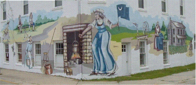
Home in the Backcountry, 1780 Mural
During the American Revolution, life at home in the backcountry was difficult for all. Families had to be self-sufficient. The children carried water and carded cotton for the spinning wheel, helped tend the kitchen garden, cared for animals, milked cows, made butter and soap. The women protected and managed the home when the men and boys were away fighting with Marion’s Brigade. (14′ x 60′ mural)
- Santee Cooper, Summerton Downtown Development Events Committee, Swamp Fox Murals Trail Society donated this mural in Summerton, SC.
- Artists: Dayton & Sandy Wodrich, Brenham, TX.
- Mural Painted on the West & East walls of old Dr. Keller’s office and the Masonic Building, Main St., Summerton, SC, May, 2004, destroyed 2009.
- Follow the Swamp Fox Murals Trail on Historic 301: Manning, Paxville, Summerton, Turbeville.