Revolutionary War Encampment
Francis Marion, The "Swamp Fox". Living History Days
Celebrate General Francis Marion Rev. War History for General Francis Marion Memorial Day on 27 February every year, a South Carolina statewide Memorial day.
Francis Marion Living History Encampment has been discontinued; for more Francis Marion History come to the Francis Marion Symposium: www.francismarionsymposium.com Manning, SC
Largest Rev. encampment in the US is annually in Camden/Kershaw, SC in November
Francis Marion Living History Encampment by Swamp Fox Murals Trail will not be held beyond 2016.
But walk back in history. February 27-28, 2015 was the Best ever (and last), with about 800 participants even with cold and held inside. American Revolutionary Francis Marion Days Living History Encampment and Celebration of “General Francis Marion Memorial Day and Victory at Wyboo Swamp”, Camp Bob Cooper, Summerton, SC. To honor General Francis Marion Memorial Day, which the South Carolina Legislature designated as February 27, the Swamp Fox Murals Trail Society sponsored General Francis Marion Days Living History (Here’s the link to pics from these many years with the students & re-enactors, a few pics are below).
See the early encampments, 2002-2011; we started to commemorate the 225th anniversary of the SC Battles of 1780.
These events are no longer held, this is a history of what was held from 2012-2016.
Celebrated February 27, 2016
(Registered students and classes Feb 25-26, 2016 – the last) at Camp Bob Cooper (R.M. Cooper Leadership Center,
8001 M.W. Rickenbaker Road, Summerton, SC 29148). (See Facebook: Francis Marion Living History Encampment for more photos)
Students from 23 classes celebrate Francis Marion and Rev. History. Photos of Encampments (below) show re-enactor stations.
Fun Time. the way to learn history.
Be a Time Traveler. Turn back the clock to the 1700’s as you walk back in time to the Carolina Backcountry Frontier.
Visit Clarendon County, SC, Summerton, Manning & Turbeville, and You follow in the footsteps of Francis Marion to experience 18th century life ways and skills: wilderness travel, food and life in the backcountry for survival, Swamp Fox Murals depict this life.
Teachers and students from local schools reserve their day to visit on Thursday or Friday. Field lay-out and participants below.
Saturday, February 27, 2016
Re-enactor stations demo Hands-on Rev. history activities all day, 9-2.
DAR Memorial to Rev. Battles and General Francis Marion were held.
Rev. History events were conveyed at each history station.
The American Revolution was deadlocked in the north, after the Battle at Monmouth Courthouse, NJ, June 28, 1778. These Swamp Fox engagements were after Charlestown fell and the British occupied it starting on May 12, 1780.
Georgetown was captured July 1, 1780. Camden was taken by the British August 16, 1780. Marion had escaped capture and was the only senior Regimental or Continental Officer free to lead the local militia. The Swamp Fox Murals Trail Society continues to honor Francis Marion with the annual Francis Marion Symposium, Manning, SC.
Revolutionary War happenings around the Santee and Black Rivers, in chronological order, 1780-1781:
The Burning of Mouzon's August 7, 1780
Francis Marion Rev. Living History Days Survival Skills: Back-country Clothing, Basket-making, Bees and Candle-making, Black-powder Flintlocks, Col. Coker’s Militia, Colonial Food and Medicine, Colonial Crafts, Colonial Games, Colonial Military Music, Colonial Surveyor, Crime and Punishment-Civilian and Military, Firestarting and Flintlocks, Fort Watson, ‘Hawk Throwing, Jaeger Hessian Camp, Joinery-Woodworking, Jack’s Creek Militia, Musket and Militia Drills, Native Points and Pots, Quill writing, Quilts, Yo-yos, Textiles and Sewing | |
Re-enactors to Francis Marion Living History at Camp Bob Cooper for Hands-on-History, 2016: Bob B, June B, Jewell B, Claire B, Doug B, Sue B, Sue C. Don C, Nancy C, Peggy C, Diane C, Larry C, Dan C, Horton D, Mary Anne D, Don E, Dick F, Nanci F, Donna G, Doyle G, Jean G, Jim G, Garland H, Barbara H, Rosemary H, Frank H, Brenda H, Ursula H, Ted J, Whit J, Gloria J, Kay K, Paul K, Rene L, Bonnie L, Karen M, Jim M, Sharon M, Bucky M, Pat P, Ken P, Mike R, Jerry R, Jack S, Bob S, Mickey S, Jim S, Dana S, Kathy T, Carrie T, Jan T, Tom T, Jim VN, Art W, Mel W, Myrna W, Paul W. Over 600 students and adults participated in Rev. history Thursday and Friday, another 100+ on Saturday. Saturday Visitors came from Alcolu, Canada, Charleston, Charlotte, Columbia, CT, Elloree, Florence, Kingstree, Lake Marion, Lexington, Manning, MI, Moncks Corner, Myrtle Beach, NY, PA, Paxville, Saluda, Santee, Savannah, Summerton, Sumter, Turbeville and more. Thank you for participating. Re-enactors came from Alcolu, Boston, Bristol, TN; Columbia, Dillon, Florence, Fayetteville, NC; Manning, Summerton, Sumter, Turbeville, Walterboro |
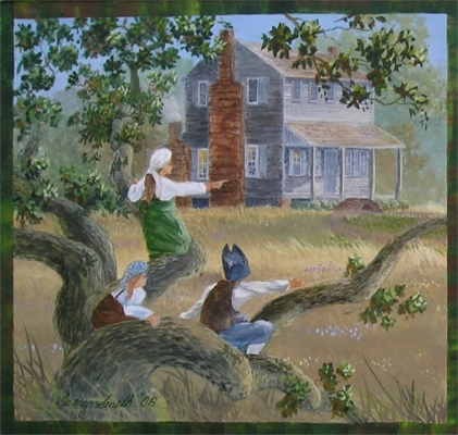
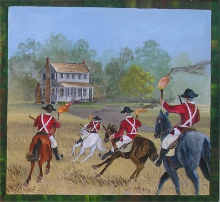
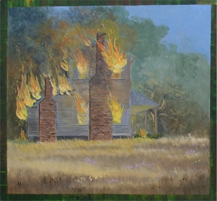
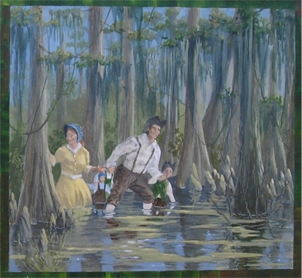
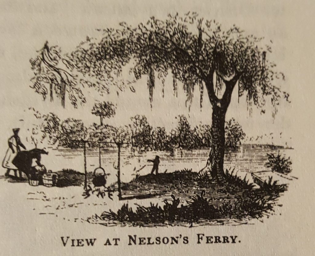
Battle of Nelson's Ferry or Great Savannah - Thursday, August 24, 1780
Below find some of the best pics of our Re-enactors working life survival skills.

Ride to North Carolina
September 8-24, 1780
After Marion’s victories at Nelson’s Ferry and the Blue Savannah, the British were angry.
A Horse For Francis Marion
September 28-29, 1780
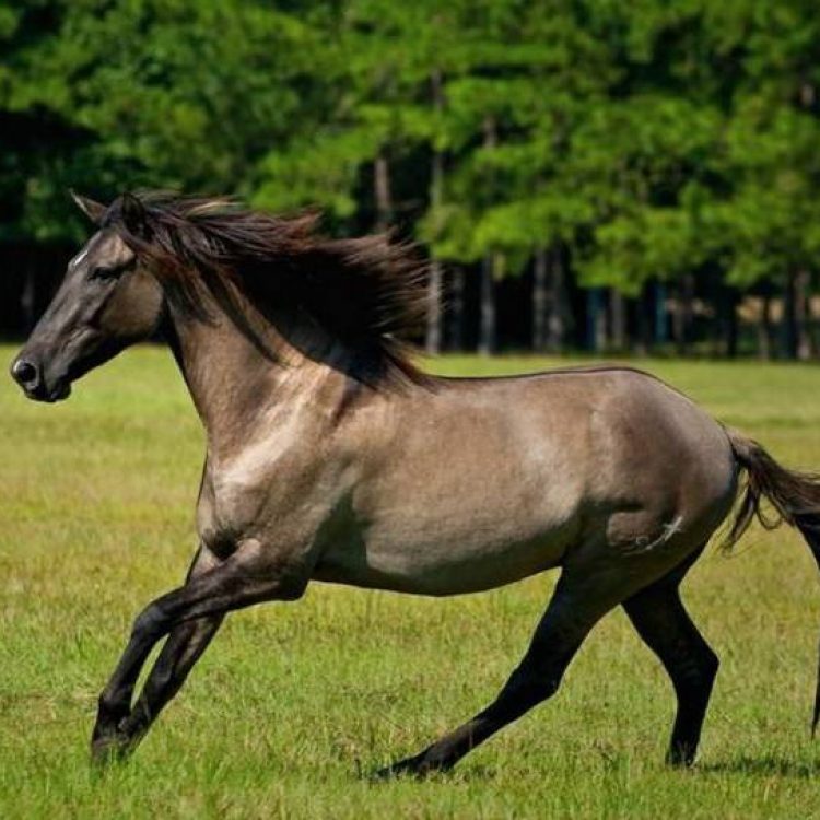
Marion, back in SC, attacked Col. Ball at Black Mingo, Mouzon was wounded. Francis Marion and his men needed horses for the way they fought and his guerrilla tactics throughout this Santee and Black River area. It was important for Marion to have a strong horse. Marion found exactly what he needed.
At Black Mingo Creek, in Williamsburg County, just east of Kingstree. September 28-29, 1780 Marion militiamen attacked Col John Cummins Ball, a Tory, and his men at Black Mingo. He captured Col. Ball’s horse and rode him the rest of the war and long after and called him “Ball”.
For map and personnel involved in engagement, see JD Lewis slide 46

Confrontation at Richbourg's Mill
Tuesday, November 7, 1780
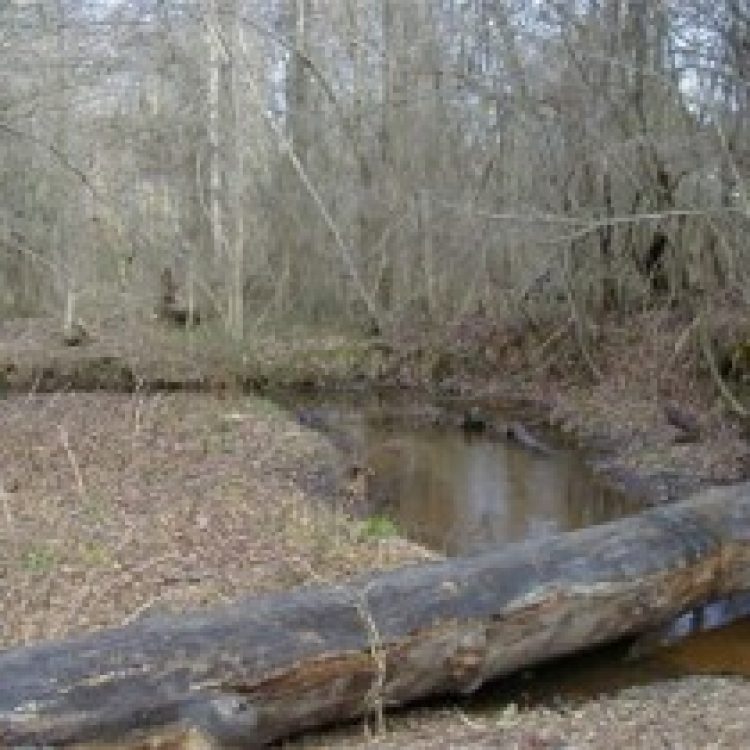
Directions: I-95 Exit 108, from junction of Historic US 301 and US 15 in Summerton go west on Gov. Richardson Road (SR 26). Site is on the Furse Branch just west of Jack’s Creek. When Marion learned of the ambush Tarleton had prepared he quickly withdrew to the east of Jack’s Creek, near Richbourg’s mill and plantation.

Pursuit to Ox Swamp
Wednesday, November 8, 1780
Directions: I-95 Exit 119 – go east on SC 261. I-95 Exit 122 – go east on US 521. The road crosses Ox Swamp just east of Manning.
Upon learning from a Tory spy that General Marion slipped back east of Jack’s Creek, Tarleton gave chase with his Green Dragoons. Marion, staying just ahead of the dragoons, and fighting a series of delaying tactics with his rear guard, rode to the head of Jack’s Creek, Sammy Swamp and then down the Pocotaligo and slipped away into Ox Swamp. Here Tarleton gave up the chase and said “as for the old fox, the devil himself could not catch him.” Thus, General Francis Marion became known as the “Swamp Fox”. Marion and his men continued east to Benbow’s Ferry on the Black River where he had established the ambush for the British.
- Find Ox Swamp and the Pocotaligo: 33° 41′ 32″ N 80° 12′ 03″ W
- SC ETV “Chasing the Swamp Fox” on-line. https://www.youtube.com/
Ambush Set at Benbow's
November 8, 1780
On November 8, 1780, after a seven-hour, 26 mile chase, of Col. Francis Marion by Lt. Col. Banastre Tarleton, he, Tarleton, gave up at Ox Swamp, just a few miles short of Benbow’s. Col. Francis Marion and his band of Patriots remained at Benbow’s Ferry on the Black River where he had prepared his own ambush for Lt. Col. Tarleton – however, Tarleton never came, but instead began burning homes in the vicinity, including the barn of Mrs. Richardson and all her livestock.
- Benbow’s Ferry Site
- Directions: East of Manning on SC 261. Left, north, onto S-55 at Martine Crossroads.
- The ferry was located just east of where the bridge crosses the Black River.
- Marion positioned his force in an ambush for Tarleton along the approach to the ferry.
- See the latest mural in Manning of this event, West facing wall of Piggly Wiggly.
Battle of Halfway Swamp
Tuesday, December 12, 1780
Directions: South of Summerton, I-95 Exit 102 north on Historic US 301. At St. Paul turn west on Liberty Hill Road (SR 373), then left onto Old River Road (SR 76). Site is on the left just past Elliott’s Mill Pond and Spring Grove Creek.
Major McLeroth and his British Regular troops met at Nelson’s Ferry recruits for the Royal Fusiliers, who departed Charleston for Camden. McLeroth was to escort them to the High Hills. At Halfway Swamp, General Marion with 700 troops intercepted McLeroth’s group and began driving in the pickets. Under a flag of truce McLeroth complained and after they talked, it was decided each side would field twenty men to face off and fight. Major Vanderhorst and the picked twenty decided to wait until they were fifty yards away to fire their buckshot. As they closed to less than 100 yards, the Redcoats broke and ran. During the night the British stole away, leaving their equipment and supplies behind. Marion sent James and his cavalry after them. James fired on the British at Singleton’s Mill but quickly departed the mill area when he learned the Singletons had smallpox. December 26, 1780, Lt. Col. John Watson Tadwell Watson and the British 64th Regiment of Foot troops started building Fort Watson on the Santee Indian Mound.
- Find this Halfway Swamp FMTC historic marker: 33° 39′ 15″ N 80° 29′ 43″ W
First Battle of Fort Watson
Tuesday, February 27, 1781
Directions: South of Summerton, I-95 Exit 102. Historic US 301 north, turn west onto Fort Watson Road (S- 803). Marker at the Visitors Center and the Indian Mound, site of Fort Watson, is at the end of the road.
General Thomas Sumter had attacked Fort Watson atop the Indian Mound on February 28, 1781, attempting to take it from the British.
- For more on these events with Thomas Sumter see JD Lewis’s Carolana.com
The next sequence of events comprise the Bridges Campaign or Watson Pursuit (March 6-28, 1781)
Battle of Wyboo Swamp
Tuesday, March 6, 1781
Directions: I-95 Exit 115. Take Historic US 301 north. Turn south (right) onto SC 260. Turn right on Patriot Road (SR 410). The site is at the end of the road.
Lt. Col. John Watson Tadwell Watson and Colonel Welbore Ellis Doyle were sent to encircle and crush General Marion. Early on March 5, Watson and his Buffs marched from Fort Watson down the Santee Path and bivouacked near Nelson’s Ferry. Marion heard their location from his spy, Capt. Zach Cantey.
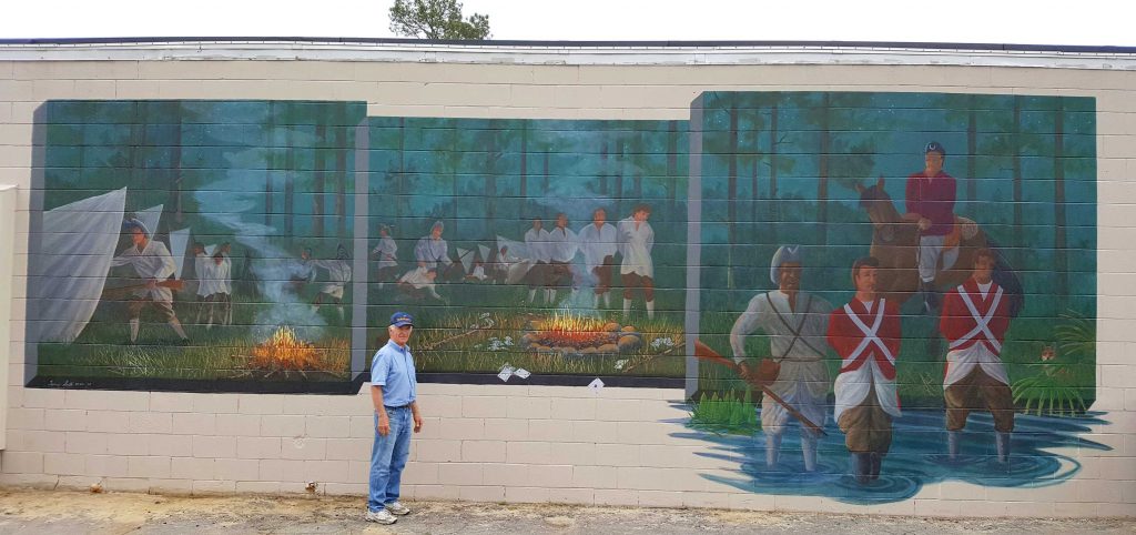
His men knew they must fight to prevent the enemy from continuing to overrun their homes and farms. Marion ordered his troops to advance and set up an ambush, at Wyboo Swamp, a difficult pass on the Santee Road. The British marched into view and out rode Watson to survey the scene. Out rode Marion to face his opponent. The quarter-mile causeway spanned the muck and morass of Wyboo swamp. Watson, towering and majestically uniformed, sitting a splendid charger and backed by Britain’s finest soldiers, opposite the small Huguenot, sitting a sorrel gelding and backed by farmers in homespun.
Watson opened the battle. He sent Col. Henry Richbourg and his Loyalist horsemen thundering over the causeway. Anticipating this, Marion sent Lt. Col. Peter Horry and his horsemen to meet them. After a brief skirmish on the narrow roadway, both sides recoiled. Marion again ordered Horry to charge. Watson’s regulars held. A fusillade of grapeshot sent Horry’s cavalry reeling backward.
Watson threw in the Tory dragoons. Gavin James, powerful of frame and fierce of courage, turned back to dispute Harrison’s passage. Mounted on a gray horse and armed only with musket and bayonet, he threw himself directly in the path of the dragoons. Their foremost man he dropped with buckshot. Before he could reload, a dragoon rushed him with his saber. James slew him with his bayonet, and a second with the same bayonet. In falling he seized the barrel of James’ gun and for 50 yards in his retreat Gavin James dragged the dying Tory. As the dragoons crossed the causeway, Marion’s militia charged, driving the Tories back across Wyboo. Watson ordered his Guards to clear the passage. Marion knew his men could not stop the veterans and called them to mount and retreat. Marion withdrew to a position near the John Cantey Plantation (near the family cemetery).
Find Wyboo Swamp historic marker: 33° 32′ 22″ N 80° 13′ 04″ W
- JD Lewis with www.Carolana.com covers the “Bridges Campaign” from Wyboo to the Sampit with maps, take a look:
- Clarendon Co. March 6, 1781: http://www.carolana.com/SC/Revolution/revolution_wiboo_swamp.html
- Williamsburg Co. March 8, 1781: http://www.carolana.com/SC/Revolution/revolution_mount_hope_swamp.html
- Williamsburg Co. March 12-13, 1781: http://www.carolana.com/SC/Revolution/revolution_witherspoons_plantation.html
- Williamsburg Co. March 14-15, 1781: http://www.carolana.com/SC/Revolution/revolution_black_river_bridge.html
- Williamsburg Co. March 15-16, 1781 http://www.carolana.com/SC/Revolution/revolution_blakelys_plantation.html
- Georgetown Co. March 20. 1781: http://www.carolana.com/SC/Revolution/revolution_sampit_bridge_1.html
- Or similar version: March 28. 1781: http://www.carolana.com/SC/Revolution/revolution_sampit_bridge_2.htmlenry
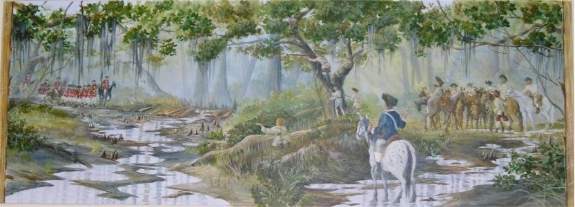
Battle of Wyboo Swamp Mural (1 of 3 panels), Manning. Wyboo Mural ©2006
Mount Hope Harassment
March 10-28, 1781
Directions: South of Manning, south on SC 260, left on Kenwood Road (S-323). Large brick and metal gate on the right, south side, of the road mark John Cantey’s Plantation.
Colonel Watson encamped at the Cantey Plantation on March 9, 1781. He then attempted to join Doyle who was moving from Camden down the Pee Dee north of the Black River. At Mount Hope Swamp Watson met severe harassment from the Swamp Fox and his men. He again met stiff resistance at the Lower Bridge over the Black River and was unable to cross the river to reach Kingstree. He then camped at the Witherspoon and the Blakely plantations but was forced to head for Georgetown. He was ambushed and stopped at Ox Swamp and then made a dash for Georgetown via the Old River Road. When the British reached the Sampit River, General Marion ambushed them. Watson had suffered many casualties at every encounter and leaving his dead where they fell, he arrived at Georgetown with two wagons filled with wounded soldiers.
Siege of Fort Watson
Monday to Monday, April 16-23, 1781
Directions: I-95 Exit 102, South of Summerton. Historic US 301 north, turn west onto Fort Watson Road (S-803). Marker at the Visitors Center and the Indian Mound, site of Fort Watson, is at the end of the road.
Colonel Harry Lee and Lee’s Legion from Virginia had joined General Marion and Marion’s Brigade on the Black River on April 14, 1781. Marion and Lee elected to capture the British fort, built in December 1780, Fort Watson on the Santee and beside Scott Lake, to secure the area and to get badly needed supplies. They laid siege to the fort. The cannon never arrived. “Col. Maham contrived to raise a tower of logs, so high that it overtopped the fort.” The tower was erected over night after collecting saplings for several days. The use of the tower by the McCottry riflemen at sunrise led to the quick surrender of Fort Watson by Lt. James McKay on the morning of April 23, 1781 and was the final Battle of Fort Watson ( http://www.carolana.com/ ),
- Fort Watson mural
- Fort Watson mural is on the North facing wall of Summerton Hardware, Main Street.
- Historic marker
- Former Crypt cover
Fort Motte
May 8, 1781 Marion and Lee arrived at Fort Motte.
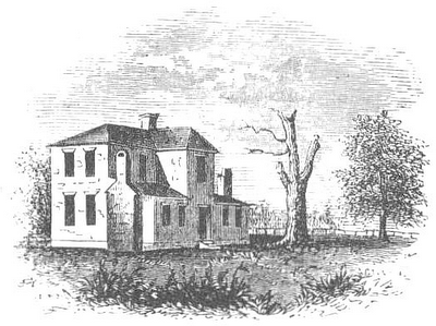
The Rebecca Motte home was located on the south side of the Congaree River just west of the Congaree and Wateree joining to form the Santee River.
Marion’s militia along with Lee’s Legion, laid siege to Fort Motte May 8, 1781. They dug trenches to get closer to the home the British had fortified. On May 12 the Patriots asked and Mrs. Motte agreed, they would set fire to the house. A bow and arrows or pitch balls were used to set the wood shingles on the roof on fire. As the roof started to burn the British surrendered and both groups worked to put it out. That evening Mrs. Motte had dinner cooked for the officers from both sides.
While eating, Gen. Marion was told some of Lee’s men were hanging the British prisoners. Marion immediately stopped this action and protected the prisoners.
May 12, 1781 Patriots, led by Francis Marion and Henry Lee, captured the British post known as Fort Motte (at Rebecca Motte’s Mount Joseph plantation, sketch from BJ Lossing in 1840s).
The British had used Fort Motte ( http://www.carolana.com/ ) as another of the outposts to guard Charles Town.
Statue
General Francis Marion in St. Mark’s Parish, now Clarendon County, is in the Continental uniform of his 2nd SC Regiment after he occupied Georgetown, June 6, 1781.
Marion statue is sponsored by the Swamp Fox Murals Trial Society.
Come to Manning to see Francis Marion in the Clarendon County Chamber of Commerce window, 19 N. Brooks Street.
These Swamp Fox engagements were after Charlestown fell and the British occupied it starting on May 12, 1780. Marion had escaped capture and was the only senior Regimental or Continental Officer free to lead the local militia. Find this statue: 33.696° N 80.211° W

First South Carolina Flag
British held Fort Johnson, built on James Island in 1747 to protect Charlestown, was attacked by South Carolina patriots in 1775. Lt Col Motte’s unit finally reached Fort Johnson the morning of 14 Sept 1775, but found it abandoned. The Patriots quickly prepared to defend the fort. Col Moultrie asked the Council of Safety what flag should be flown over the fort. The Council said to make one. Col Moultrie wrote that, “I was desired by the council of safety to have one made, upon which, as the state troops were clothed in blue, and the fort was garrisoned by the 1st and 2nd regiments, who wore a silver crescent on the front of their caps, I had a large blue flag made with a crescent to be in uniform with the troops.” So this flag was carried by Colonel William Moultrie’s South Carolina State Troops on Sullivan Island in Charlestown Harbor on June 28, 1776. The British were defeated that day, keeping the south from British occupation for another two years. Some versions of this flag have the word “LIBERTY” in the crescent moon.
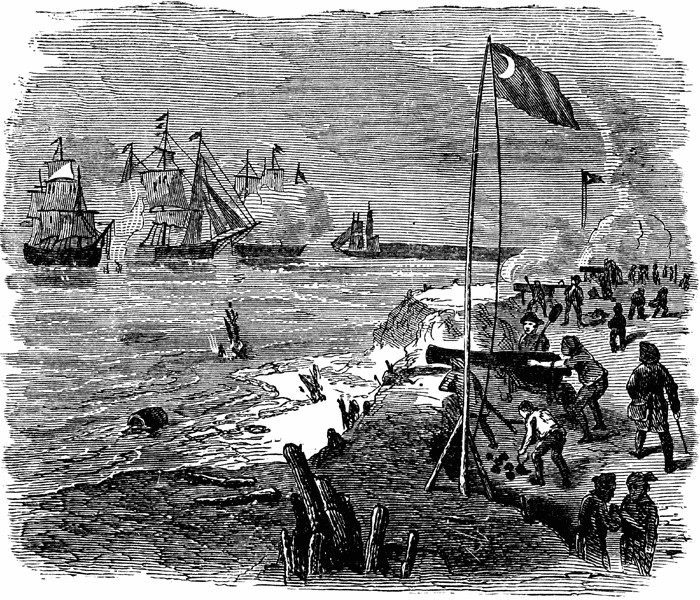
Fort Sullivan, “Palmetto Fort”
June 28, 1776
To increase the security of the Charlestown harbor, in February 1776, the Council of Safety of South Carolina directed Colonel Moultrie to build a for on Sullivan’s Island. On the morning of June 28, the British fleet was positioned to attack the fort that was only about half finished. The fort was being built using palmetto trees and sand. Many people thought the palmetto logs were not suitable to withstand an attack. At about 11:00 o’clock in the morning Commodore Parker signaled the British ships to start firing their cannons at the fort. Some of the shells were 13 inches in diameter. The ships came as close as 400 yards (4 football field lengths) from the fort as they attacked. The palmetto logs stopped the British cannon balls. The British sailed away after they lost several ships and many sailors were killed and wounded.
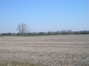
General Richardson Home Site
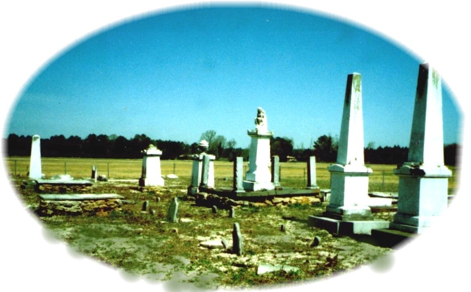
General Richardson, Richardson Cemetery and St Mark's Parish Church
Directions: I-95 Exit 102 north on Historic US 301. At St. Paul turn west on SR 373, then left onto SR 76. Site is on the left just past Richardson Branch. Richard Richardson had come from Virginia as a land surveyor in the 1750’s; he was granted 1,000 acres in Craven County in St. Mark’s Parish on the north side of the Santee River and acquired many more. He was a colonel of militia in1757 and he was in the Cherokee War of 1760-1761 and the Snow Campaign, the winter 1775-1776. He was taken prisoner when Charlestown was captured 1780. Likely on November 8, 1780, in an effort to teach the Richardsons and other Patriots a lesson for helping General Marion, Colonel Tarleton had his troops dig up General Richardson who was buried six weeks earlier and forced his family to view the body. Two SC governors and the founder of the Citadel are also buried here at this historic site. St. Mark’s Parish Church was located near here when the British burned it as they considered the church “a sedition shop”.
|
Francis Marion and the Sweet Potato Story
Francis Marion was in his camp near Snow Island on the Pee Dee River with his Militiamen. A British officer visited with Marion under a flag of truce to negotiate an exchange of prisoners. Marion offered him a meal consisting of sweet potatoes cooked in the ashes of the campfire and water to drink. The British officer returned to Charlestown and refused to fight against an enemy (the Patriots) as dedicated as Francis Marion, “who ate roots cooked in a fire and drank nothing but water from the swamp.”
There are about 12 different paintings that depict this event. All these paintings or etchings were done after General Marion died.
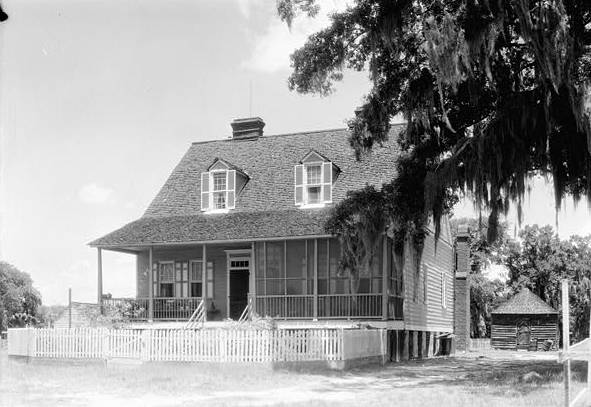
Eutaw Springs Battle
Saturday, September 8, 1781
Directions: I-95 Exit 98 east on SC 6 to Eutaw Springs.
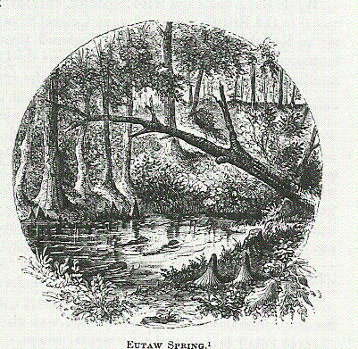
The Battle of Eutaw Springs was the last large battle fought in the campaign to end British occupation of the Carolinas and Georgia. On September 8, 1781, Major General Nathanael Greene’s Continental Army accompanied by militia (Marion and his Militia led the 4 militia front line) attacked the British Army under the command of Lt. Col. Alexander Stewart at Eutaw Springs. Over 4000 men fought for more than 4 hours in the stifling heat. It was the bloodiest battle of the Revolutionary War and soldiers reported wading through puddles of blood on the field and men were standing, dead, impaled on each other’s bayonets. When the carnage was over, the British evacuated the area and moved to Charlestown Neck. Five weeks later, when the British surrendered at Yorktown, they had no claim to the Carolinas and Georgia.
- The Battle of Eutaw Springs ( http://www.carolana.com/ ) had ended British control. (from Christine Swager: “The Valiant Died”). Find this battlefield: 33° 24′ 26″ N 80° 17′ 55″ W
- Francis Marion’s home was on the banks of the Santee River, between Eutaw Springs and Belle Isle, called Pond Bluff; picture from 1930s and the 3rd version called Pond Bluff.
- Francis Marion’s Tomb is a SC State Site near Pineville: 33° 27′ 14″ N 80° 05′ 14″ W
- Karen’s presentation at Marion’s grave https://www.youtube.com/
Cantey Plantation
Directions: South of Manning, I-95 Exit 119 east on SC 261, south on SC 260, east on Kenwood Road (S-323). Large brick and metal gate on the right, south side, of the road mark Plantation.
John Cantey’s home was about halfway between Nelson’s Ferry and Murray’s Ferry. Gen. Marion was staying here when he learned that General Cornwallis surrendered at Yorktown on October 19, 1781. Joseph Cantey, John’s father, purchased the Mount Hope Plantation about 1739. It was located east of John’s near the present Cantey Cemetery.
November 10, 1781, Saturday, Celebration party at John Cantey’s: “a fine party for the ladies of Santee”
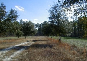
British evacuation of CharlesTown, SC
December 14, 1782
Victory Day – the successful conclusion of the Revolutionary War marked by the end of hostilities between the American Armyand the surrounded British forces occupying Charlestown; Celebrated at Marion Square. https://revolutionarycharleston.org
(Marion didn’t come to Charlestown for this in 1782, his men/Militia were not invited, so he told them he was not coming, probably using the smallpox threat.)
Fort Sullivan, “Palmetto Fort”
June 28, 1776
To increase the security of the Charlestown harbor, in February 1776, the Council of Safety of South Carolina directed Colonel Moultrie to build a for on Sullivan’s Island. On the morning of June 28th the British fleet was positioned to attack the fort that was only about half finished. The fort was being built using palmetto trees and sand. Many people thought the palmetto logs were not suitable to withstand an attack. At about 11:00 o’clock in the morning Commodore Parker signaled the British ships to start firing their cannons at the fort. Some of the shells were 13 inches in diameter. The ships came as close as 400 yards from the fort as they attacked. The palmetto logs stopped the British cannon balls. The British sailed away after they lost several ships and many sailors were killed and wounded.

Find History!
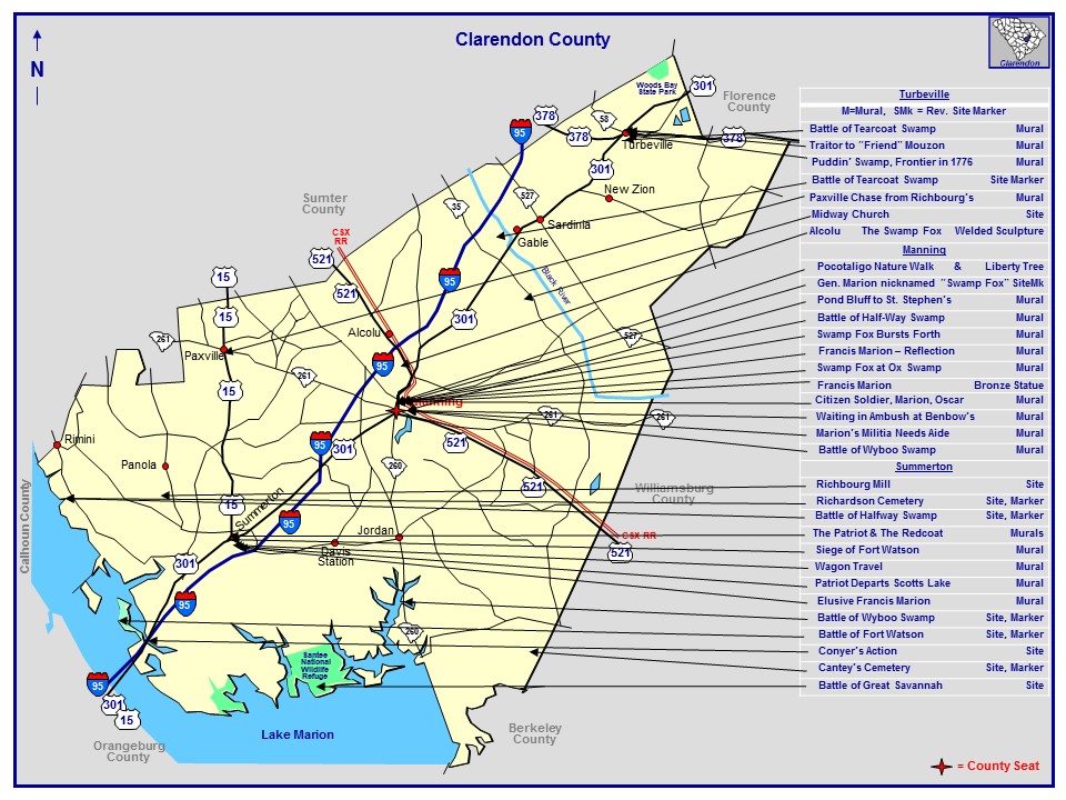
Revolutionary War Locations in Clarendon County Area
| # On Clarendon Map | Date | Location |
| 1 | 1780-08-17 | Nelson’s Ferry |
| 2 | 1780-08-25 | Great Savannah |
| 7 | 1780-10-25 | Tearcoat |
| 8a | 1780-11-08 | Jack’s Creek |
| 8b | 1780-11-08 | Ox Swamp |
| 13 | 1780-12-12 | Halfway Swamp |
| 14 | 1780-12-13 | Singleton’s Mill |
| 16 | 1780-12-17 | Santee River Rd |
| 22 | 1781-03-06 | Wiboo Swamp |
| 23 | 1781-03-06 | Cantey Plantation |
| 24 | 1781-03-13 | Mt. Hope Swamp |
| 37 | 1781-04-15 | Fort Watson |
| 41 | 1781-08-16 | Santee River |
| 44 | 1781-09-08 | Eutaw Springs |
| 54 | Richardson Cemetery | |
| 55 | 1795-02-27 | Marion’s Tomb |
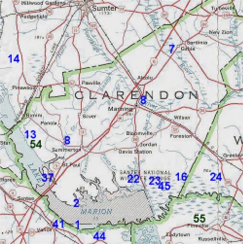
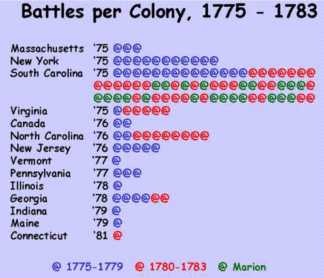
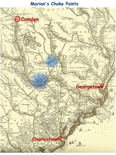
Choke points on the Santee River and Black River where Marion cut the British supply lines.

